Maps for the woods Link to section: Maps for the woods
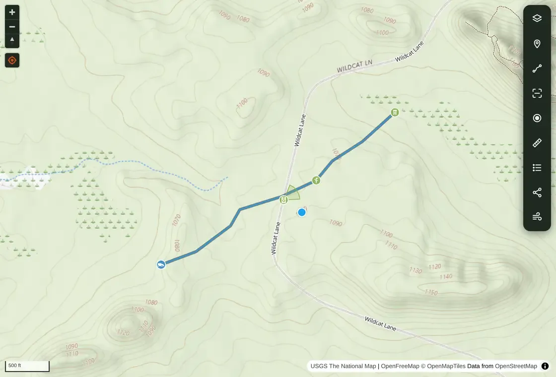
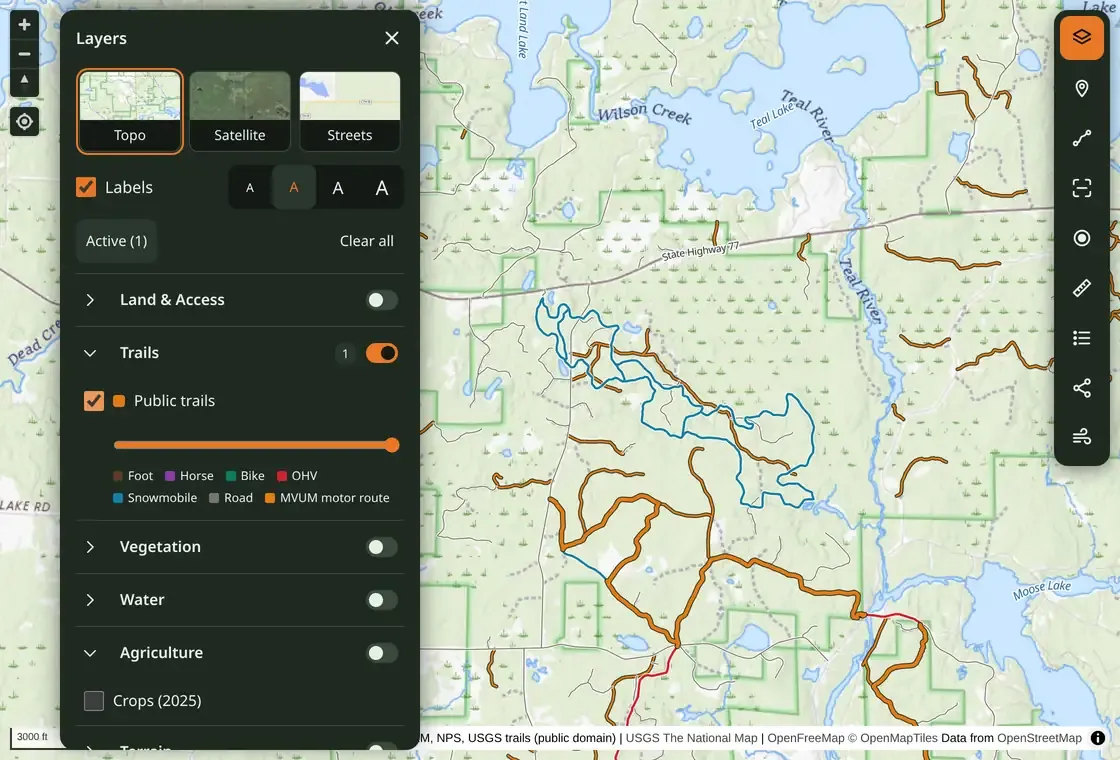
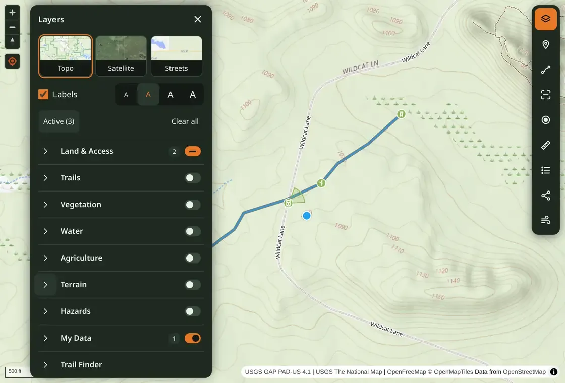
Free Hunting Map is an installable web app for hunting and camping. Switch between topographic, satellite, and street maps, then add layers for scouting:
- Public land: PAD-US (the Protected Areas Database of the United States) overlays show land managers and designations. Wisconsin parcels, public-access classes, designated wilderness boundaries, and state wildlife agency layers add context. These include hunting and game management units, wildlife management areas, and access programs such as North Dakota PLOTS and Montana Block Management.
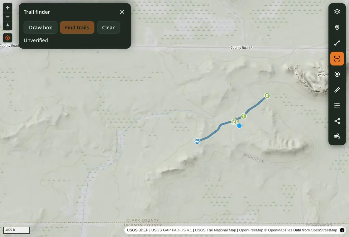
- Terrain: lidar-derived hillshade reveals ridges, drainages, and benches. The experimental Trail finder processes lidar on the device in two supported Wisconsin survey areas; its candidates are unverified clues.
- Roads and trails: federal U.S. Forest Service, Bureau of Land Management, National Park Service, and U.S. Geological Survey inventories cover public trails and motor routes across the lower 48 and Washington, DC. Other layers show Census 4WD roads, closed and decommissioned Forest Service roads, and OpenStreetMap tracks. Tap a public trail for available names, allowed uses, seasons, and source details.
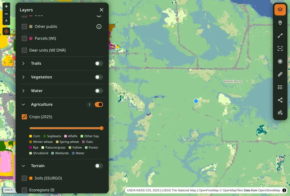
Other layers include 2025 USDA crops and Wisconsin historic aerials. Community trails show Trail finder scan results; community hikes show recorded tracks that people choose to share and can unshare.
Public ownership and mapped routes do not establish hunting permission or legal access. Confirm land status and current restrictions with the managing agency.
Pins, tracks, and trail cameras Link to section: Pins, tracks, and trail cameras
Drop a waypoint by tapping the map or using GPS, then add a name, note, and icon. Draw a track, measure distance, or record a GPS track while walking. Keep the app open when recording: mobile browsers can pause it in the background.
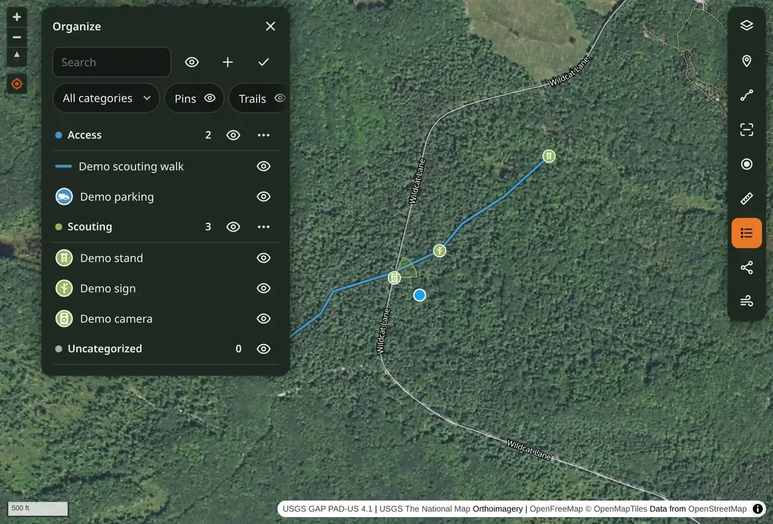
The Organize panel groups pins and tracks into colored categories, with visibility controls and offline search across names, notes, categories, and camera details.
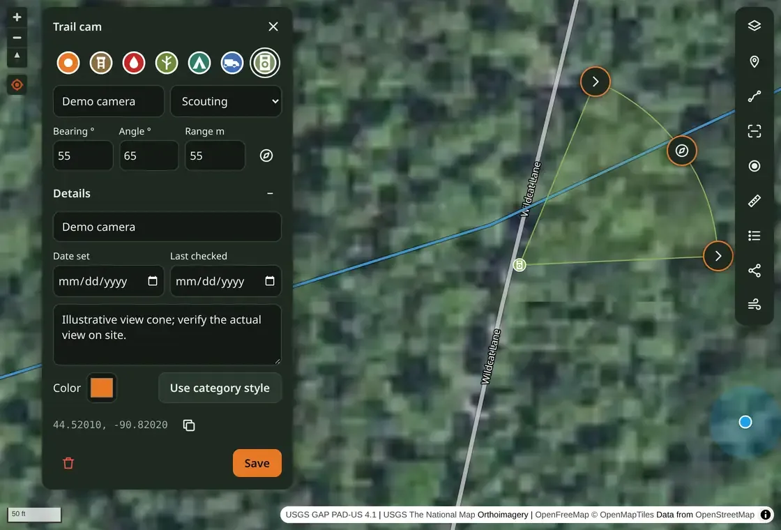
Trail-camera pins have adjustable view cones. Drag handles or enter a bearing, angle, and range, then save the camera model and set/check dates. The cone records a planned view; aim and obstructions still need checking on site.
Conditions at the map center Link to section: Conditions at the map center
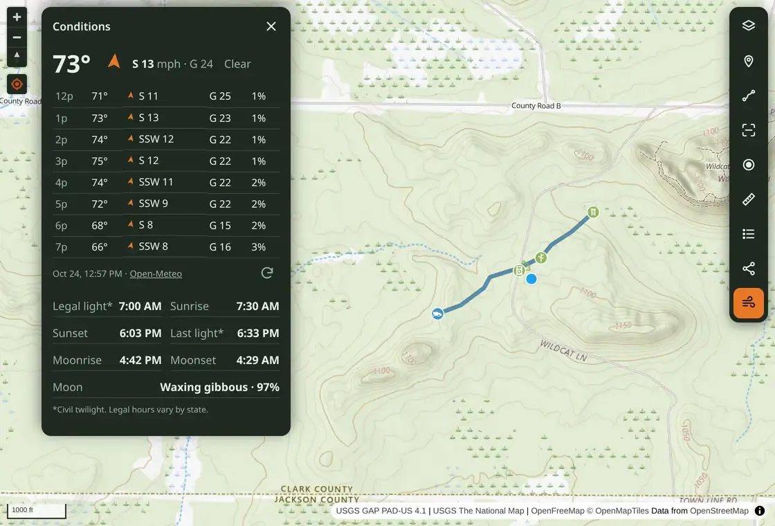
The Conditions panel combines Open-Meteo temperature, wind, gusts, and hourly weather with locally calculated sunrise, sunset, twilight, and moon information. The last forecast remains available offline with its recorded time; refreshing weather needs a connection. Civil twilight does not determine legal shooting hours.
Offline maps and sharing Link to section: Offline maps and sharing
Open the app online first. A service worker caches the app, and viewed map tiles are saved for offline use with storage limits and expiry. Only areas and zoom levels already viewed are available; there is no bulk area-download button. Browser storage can be cleared or evicted, so preview the route and test in airplane mode before leaving.
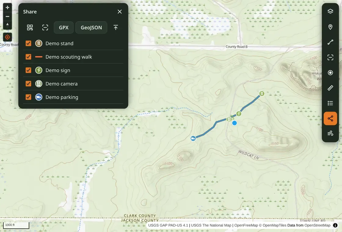
Pins and tracks stay in IndexedDB, a database on the device. Sharing works without an account:
- Export or import GPX and GeoJSON files for waypoints and routes.
- Import supported Google Takeout saved places, with list names becoming categories.
- Transfer selected items between nearby phones using numbered QR codes, without internet access.
Camera view cones, category names, and styles travel with GPX, GeoJSON, and QR transfers. Repeated imports do not create duplicates; per-item merge rules resolve updates. Optional Google sign-in syncs map items, saved lidar candidates, and map preferences across devices. Cached map tiles stay on each device.
Implementation and source Link to section: Implementation and source
The app uses TypeScript, MapLibre GL for maps, IndexedDB through idb for local data, and Vite for builds. The Free Hunting Map repository documents the offline design, merge rules, and map-data sources. Code and repository-drawn icons are MIT-licensed; third-party map and weather data retain their own terms.
FAQ
Is Free Hunting Map free?
Yes. Free Hunting Map is a free, open-source hunting and camping web app. Its code and repository-drawn icons are MIT-licensed; third-party map and weather data keep their own terms.
Does Free Hunting Map work offline?
Partly. After you open the app online, it caches the app and the map tiles you have viewed. Only areas and zoom levels already viewed are available offline, and there is no bulk area download, so test in airplane mode before leaving.
What public land data does it show?
PAD-US overlays with land managers and designations, Wisconsin parcels, public-access classes, wilderness boundaries, and state wildlife agency layers such as hunting units, wildlife management areas, North Dakota PLOTS, and Montana Block Management. Public ownership does not establish hunting permission; confirm with the managing agency.
How do I share waypoints without an account?
Export or import GPX and GeoJSON files, import supported Google Takeout saved places, or transfer selected items between nearby phones with numbered QR codes, without internet access. Optional Google sign-in syncs map items across devices.
Build photos